Scattered Showers, Potential Storms Tracked for Birmingham Area Overnight and Wednesday
Weather alerts are tracking scattered showers and potential storms for Birmingham and surrounding areas overnight and into Wednesday as a cold front moves through. While the front is expected to weaken, there is a possibility of stronger storms, particularly across…

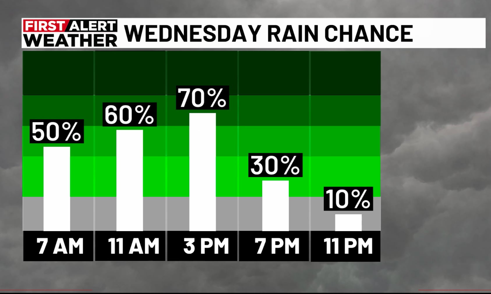
 Birmingham, AL, November 3, 2026 — Scattered showers and the possibility of thunderstorms are forecast for Birmingham and its surrounding regions beginning overnight and continuing into Wednesday, according to current weather alerts. The developing weather pattern is associated with an approaching cold front.
Meteorologists are closely monitoring the situation as the cold front makes its way through the area. While the system is generally expected to diminish in intensity, there remains a potential for stronger storm activity, especially across West Alabama on Wednesday. Residents are advised to stay informed about weather updates.
The forecast indicates that showers could begin overnight, with the chance for storms persisting through Wednesday. The precise timing and intensity of any potential severe weather remain subject to ongoing analysis as weather models update. Officials have not yet provided specific details regarding the potential severity or impact of these storms, such as timing of any watches or warnings.
The cold front’s passage is anticipated to bring a change in weather conditions following a period of warmer temperatures. The risk of stronger storms is a primary concern for Wednesday, though the overall threat level is still being assessed. Further updates will be issued as more information becomes available from weather tracking agencies.
Story summarized from the original created by Wes Wyatt on www.wbrc.com, see more information here.
Media gallery